
GIS Portfolio
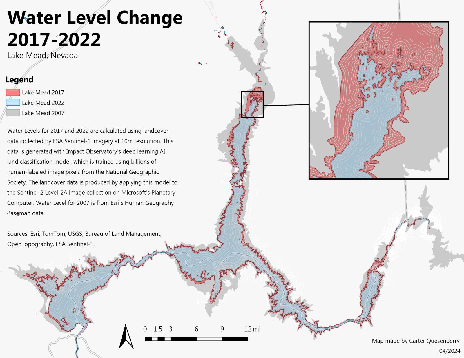
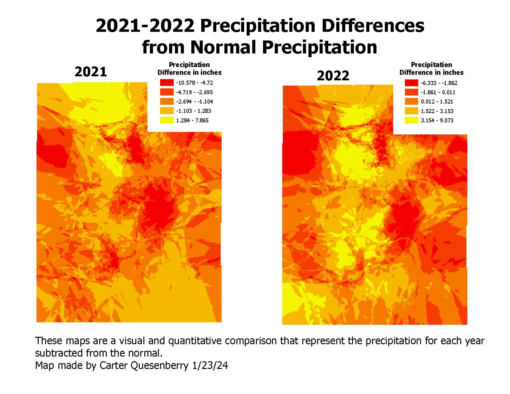
Water Level Change Analysis
2017-2022
Comprehensive analysis of water level changes in Lake Mead, Nevada using satellite imagery and historical data. The project utilized ESA Sentinel-1 imagery at 10m resolution to track water level fluctuations over a 5-year period.
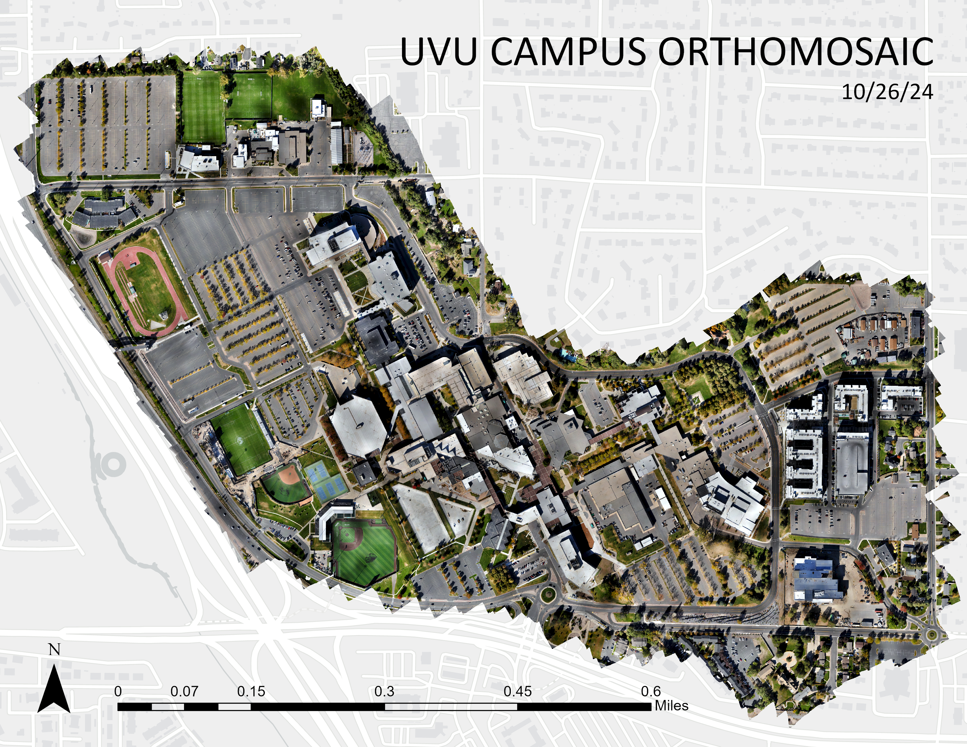
UVU Campus Orthomosaic
10/26/24
High-resolution orthomosaic mapping of Utah Valley University campus using drone photography. The project created a detailed base map for campus planning and facility management purposes with sub-meter accuracy.
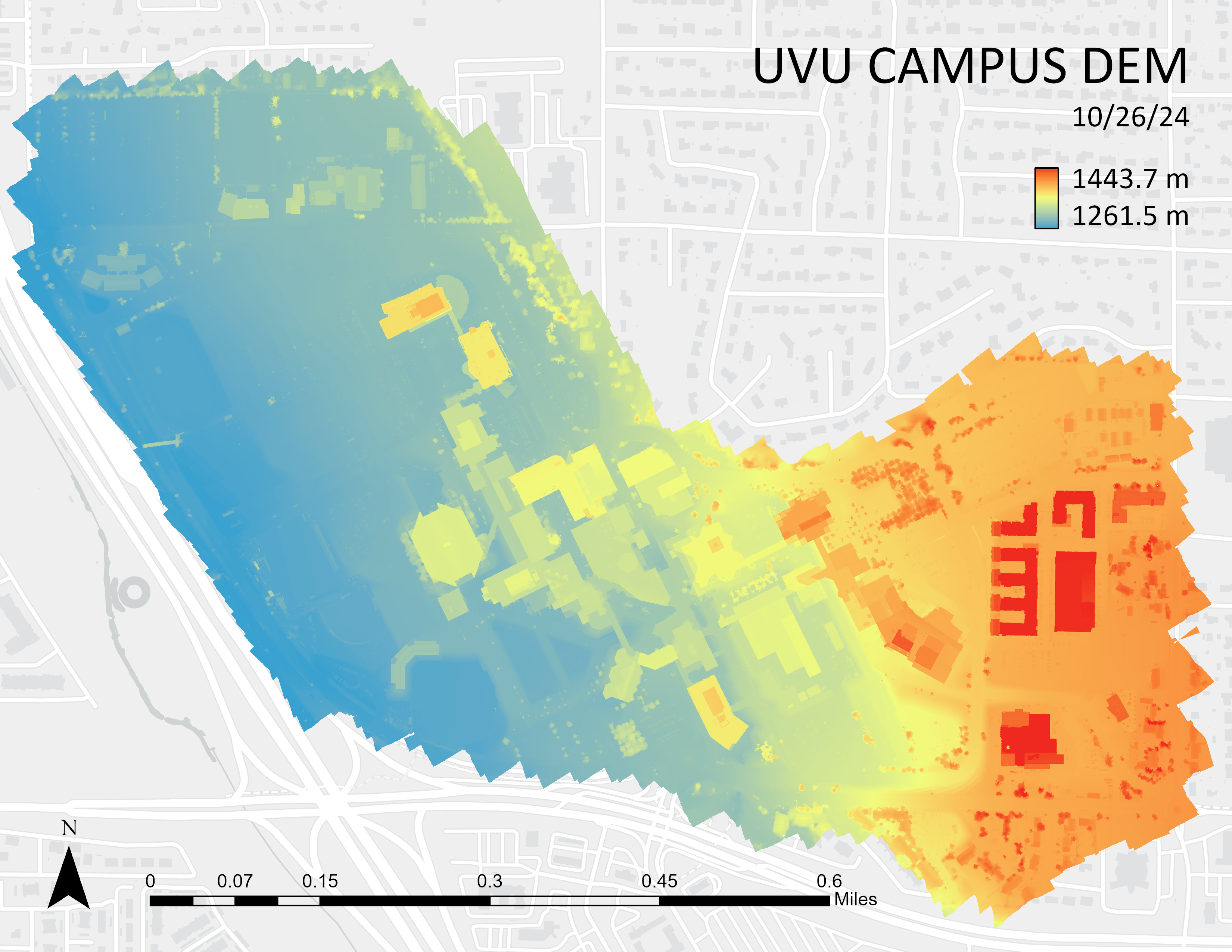
UVU Campus DEM
10/26/24
Digital Elevation Model of Utah Valley University campus showing topographic relief and elevation changes. The DEM provides crucial data for drainage analysis, site planning, and environmental studies with high vertical accuracy.
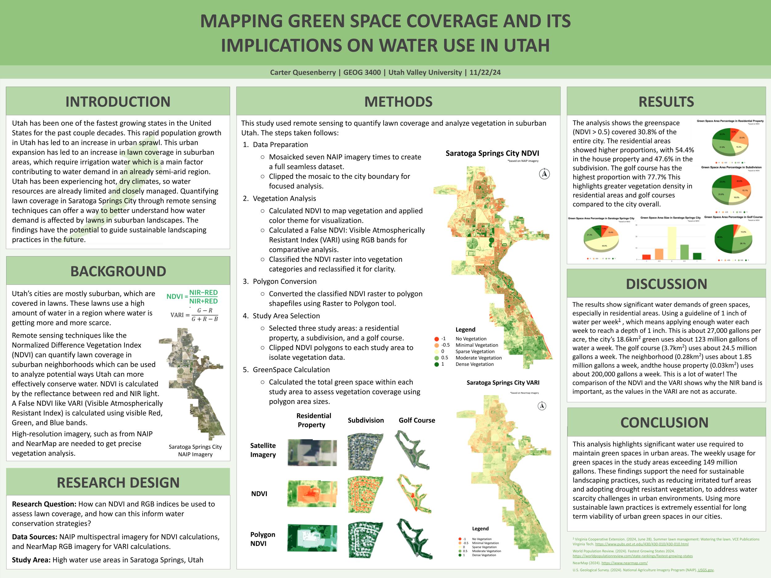
Greenspace in Saratoga Springs, Utah
Urban Planning Study
Detailed mapping and analysis of green space distribution in Saratoga Springs, Utah. This study examined urban vegetation patterns, park accessibility, and their relationship to community development and quality of life indicators.
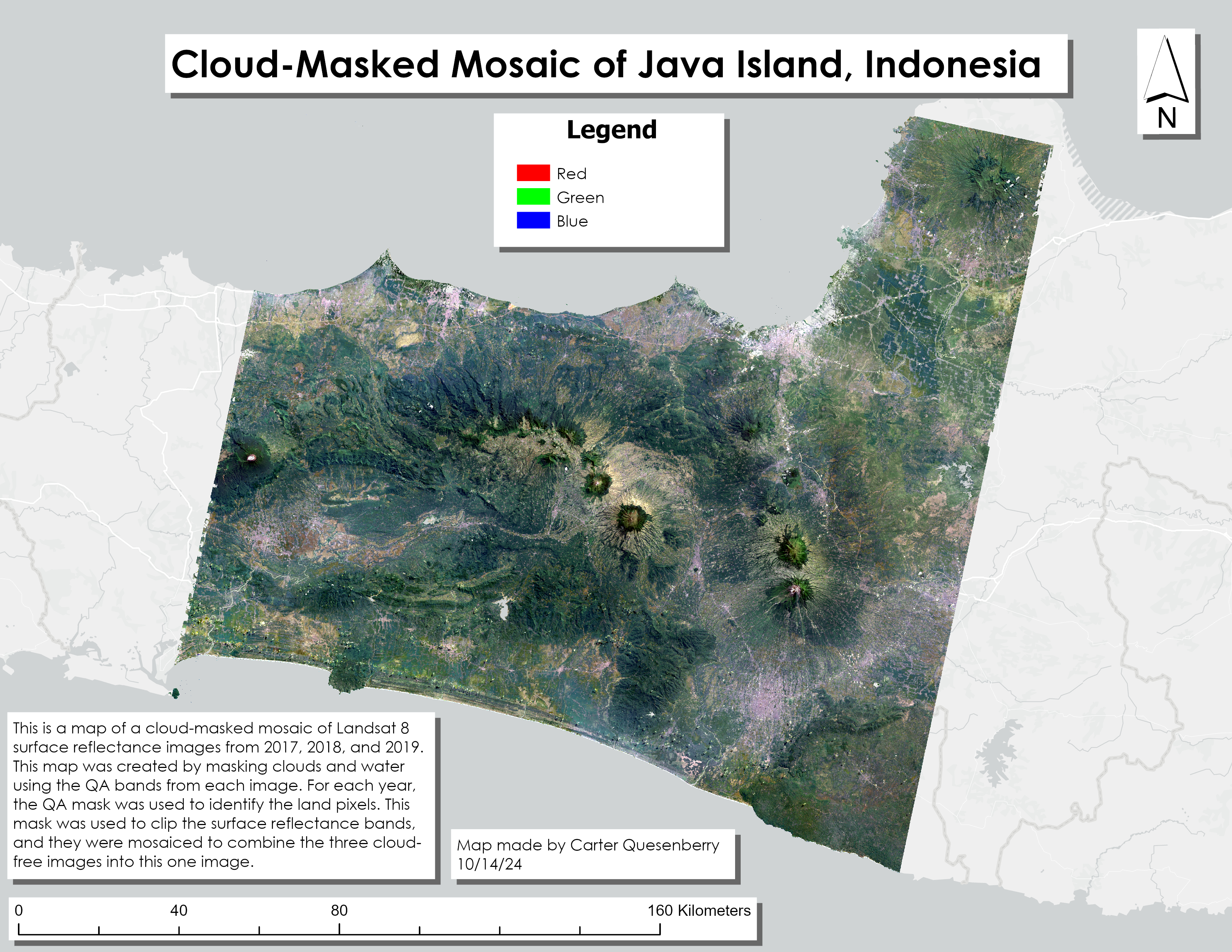
Cloud Mask over Indonesia
Remote Sensing Project
Advanced cloud masking techniques applied to satellite imagery over Java Island, Indonesia. This project developed automated cloud detection algorithms to improve the quality of remote sensing analysis in tropical regions with frequent cloud cover.
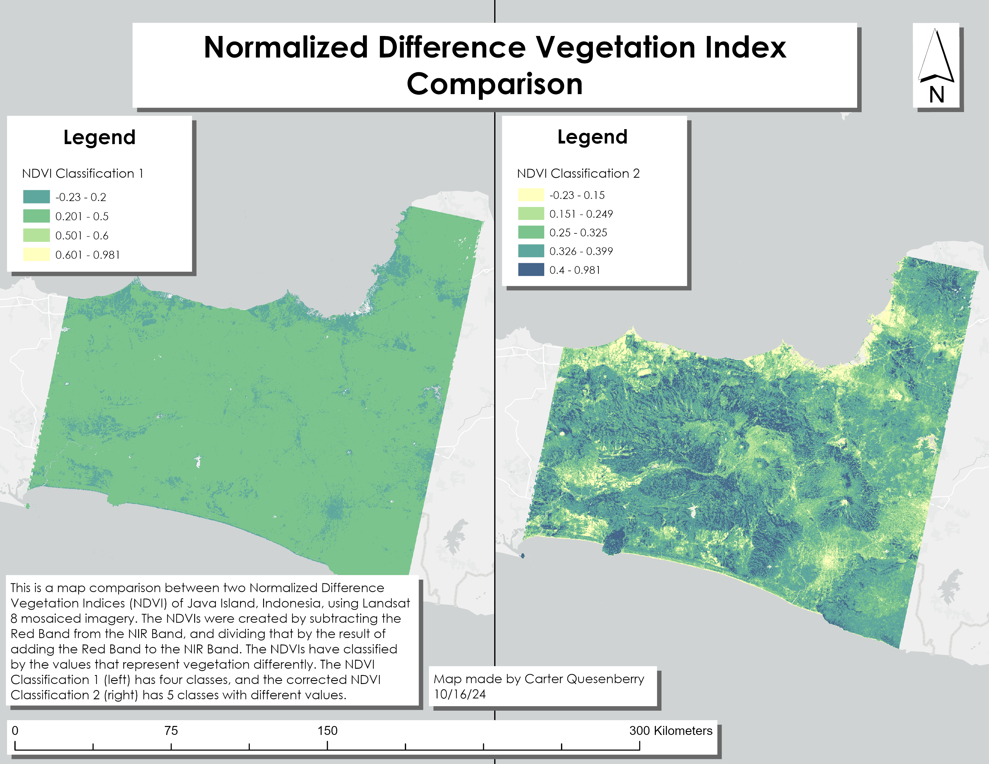
Cloud Mask NDVI Comparison
Comparative Analysis
Comparative study examining the effectiveness of different cloud masking techniques on NDVI calculations. This analysis demonstrated the importance of accurate cloud removal for vegetation monitoring and environmental assessment.
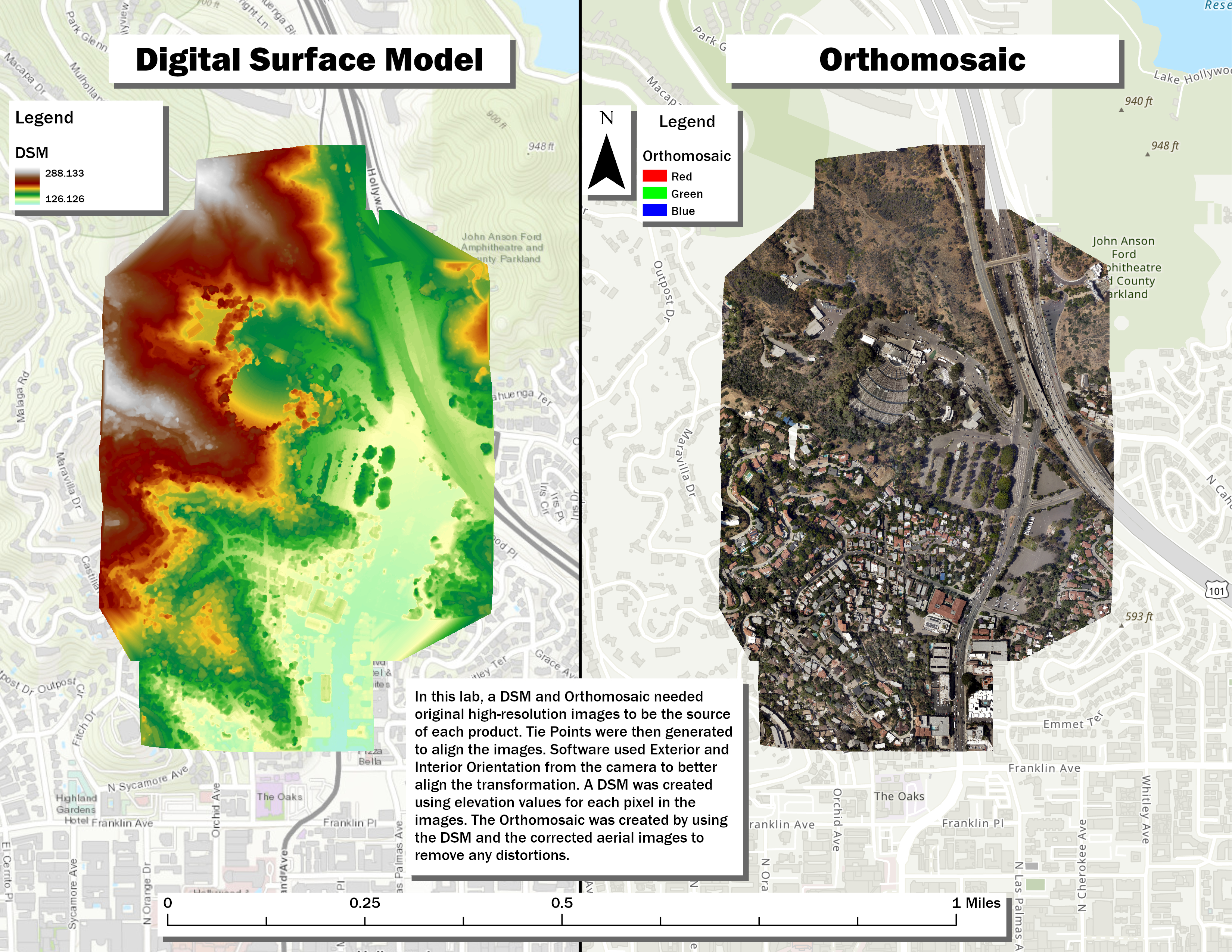
Orthomosaic Comparison
Photogrammetry Study
Detailed comparison of Digital Surface Models (DSM) and orthomosaic products generated from aerial photography. This project evaluated different processing workflows and their impact on final product quality and accuracy.
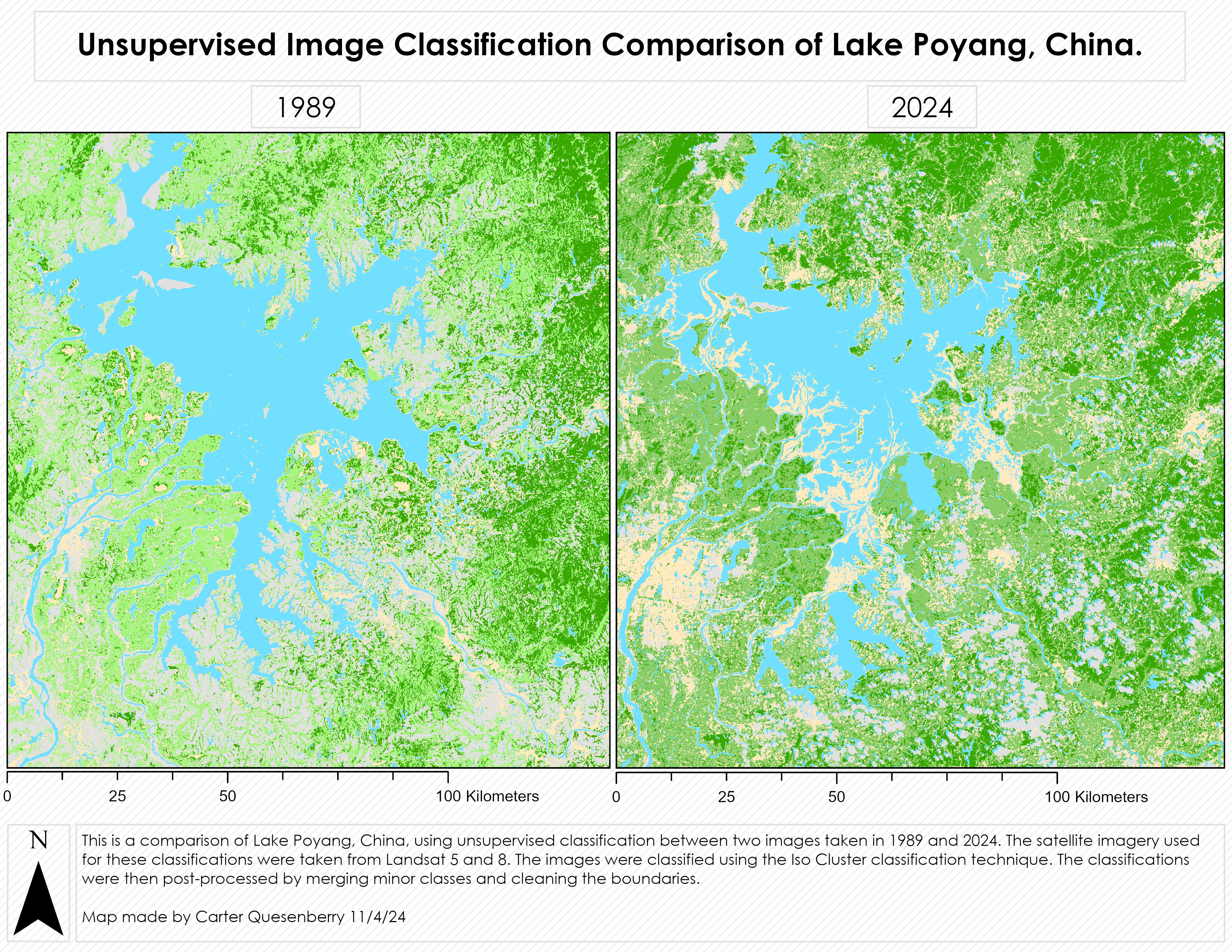
Unsupervised Classifications
Machine Learning Project
Comparative analysis of different unsupervised classification algorithms for land cover mapping. This study evaluated K-means, ISODATA, and other clustering techniques to determine optimal approaches for various landscape types.
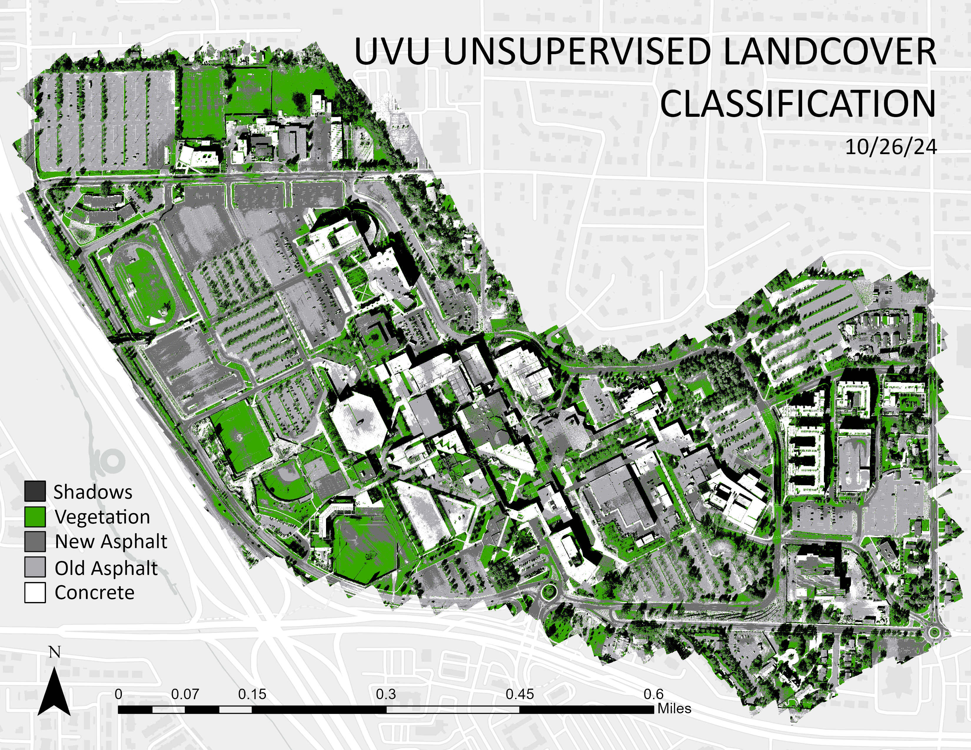
Unsupervised UVU Classification
Land Cover Analysis
Unsupervised land cover classification of Utah Valley University campus using high-resolution imagery. This project identified and mapped different land cover types including buildings, vegetation, pavement, and natural areas.
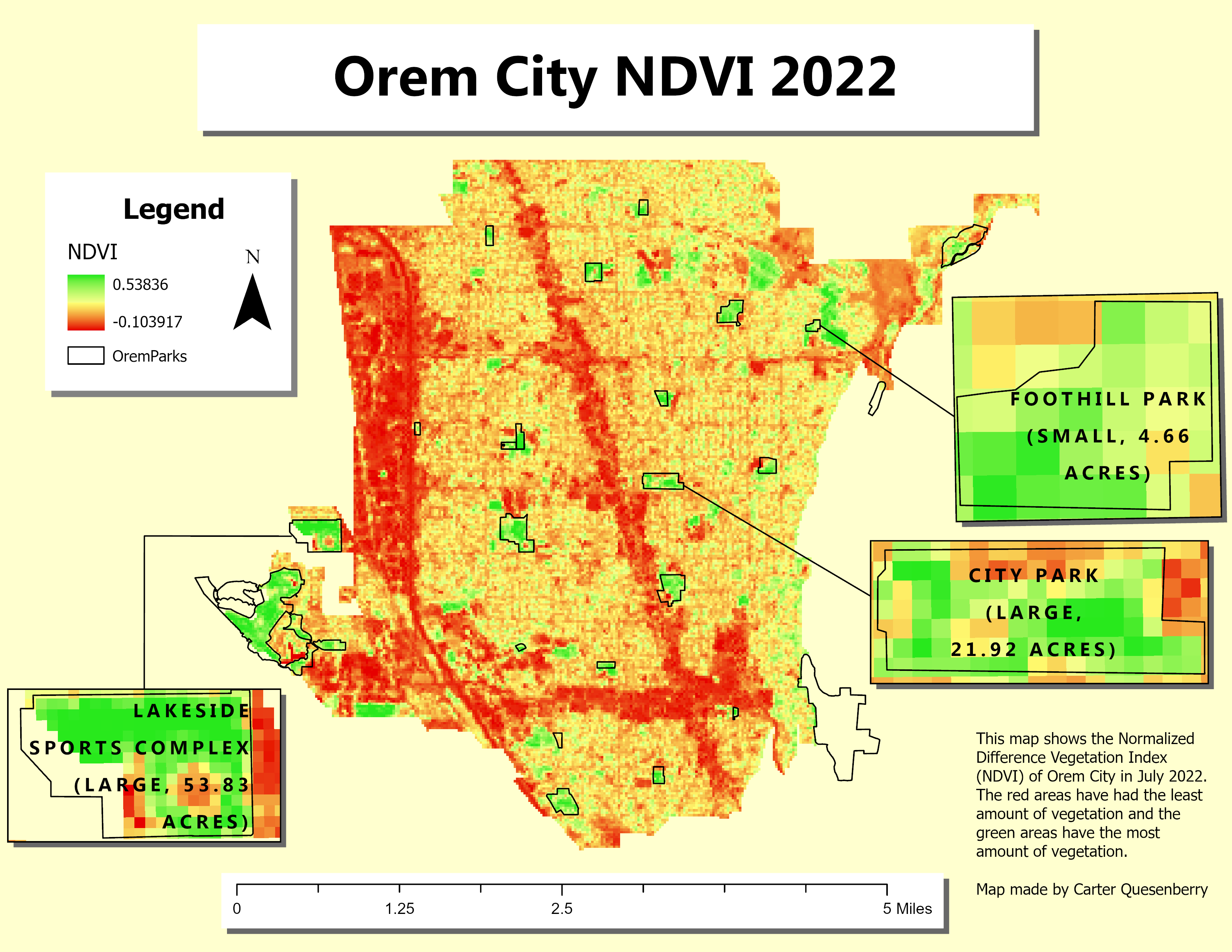
Orem City NDVI
2022
Normalized Difference Vegetation Index analysis of Orem City, Utah, providing insights into urban vegetation health and distribution. This analysis supports urban planning decisions and environmental monitoring initiatives.
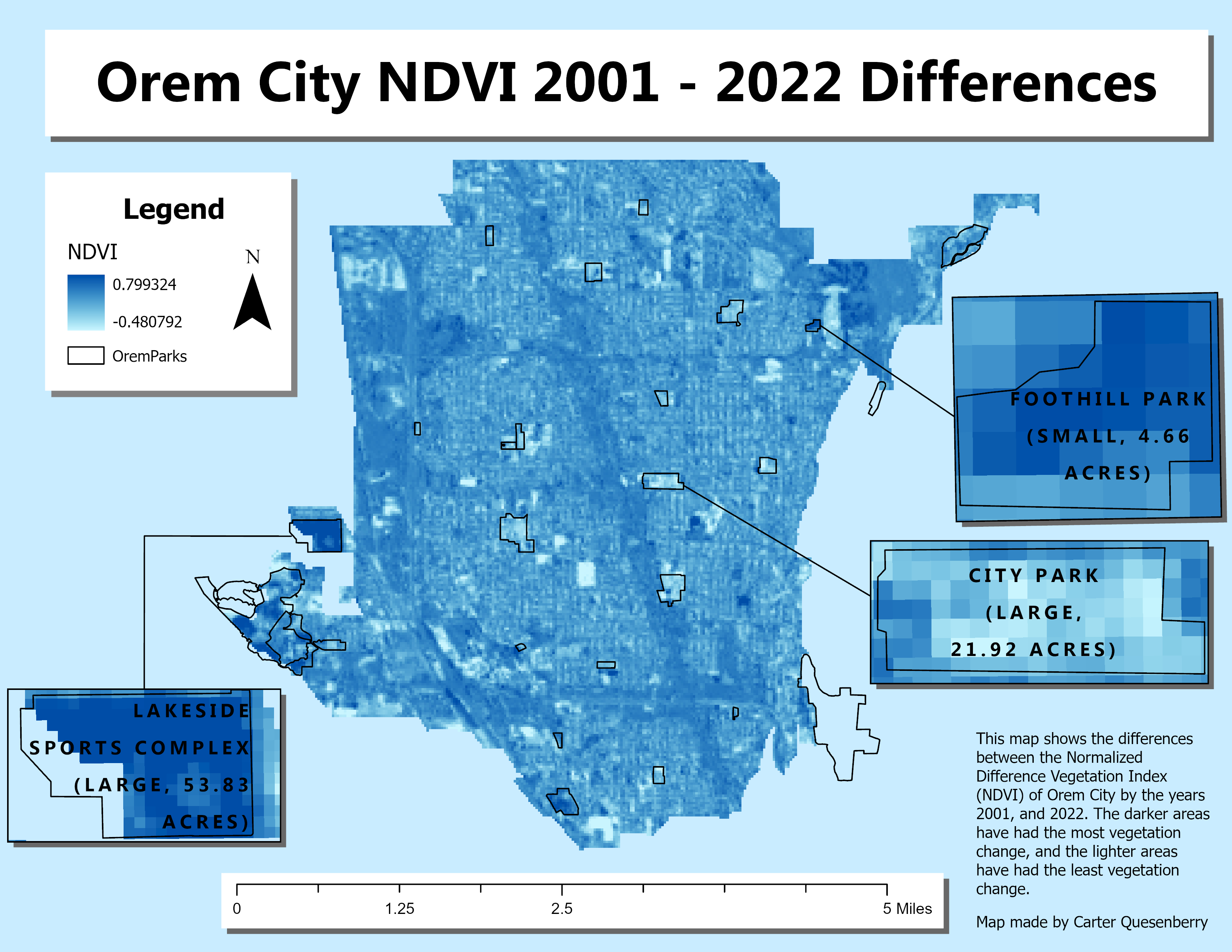
Orem City NDVI Changes Over Time
Multi-Temporal Study
Time series analysis of vegetation changes in Orem City using multi-temporal NDVI data. This project identified areas of vegetation loss and gain, supporting environmental monitoring and urban development assessment.
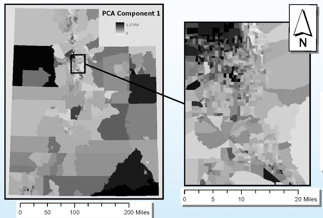
Principal Component Analysis for Utah Vulnerability
Social Research
Advanced statistical analysis using Principal Component Analysis to assess social vulnerability patterns across Utah communities. This project identified key vulnerability factors and created composite vulnerability indices for policy planning.
Utah Precipitation Interpolations
Climate Analysis
Spatial interpolation analysis of precipitation patterns across Utah using various geostatistical methods. This project compared different interpolation techniques to create accurate precipitation surface models for climate research.
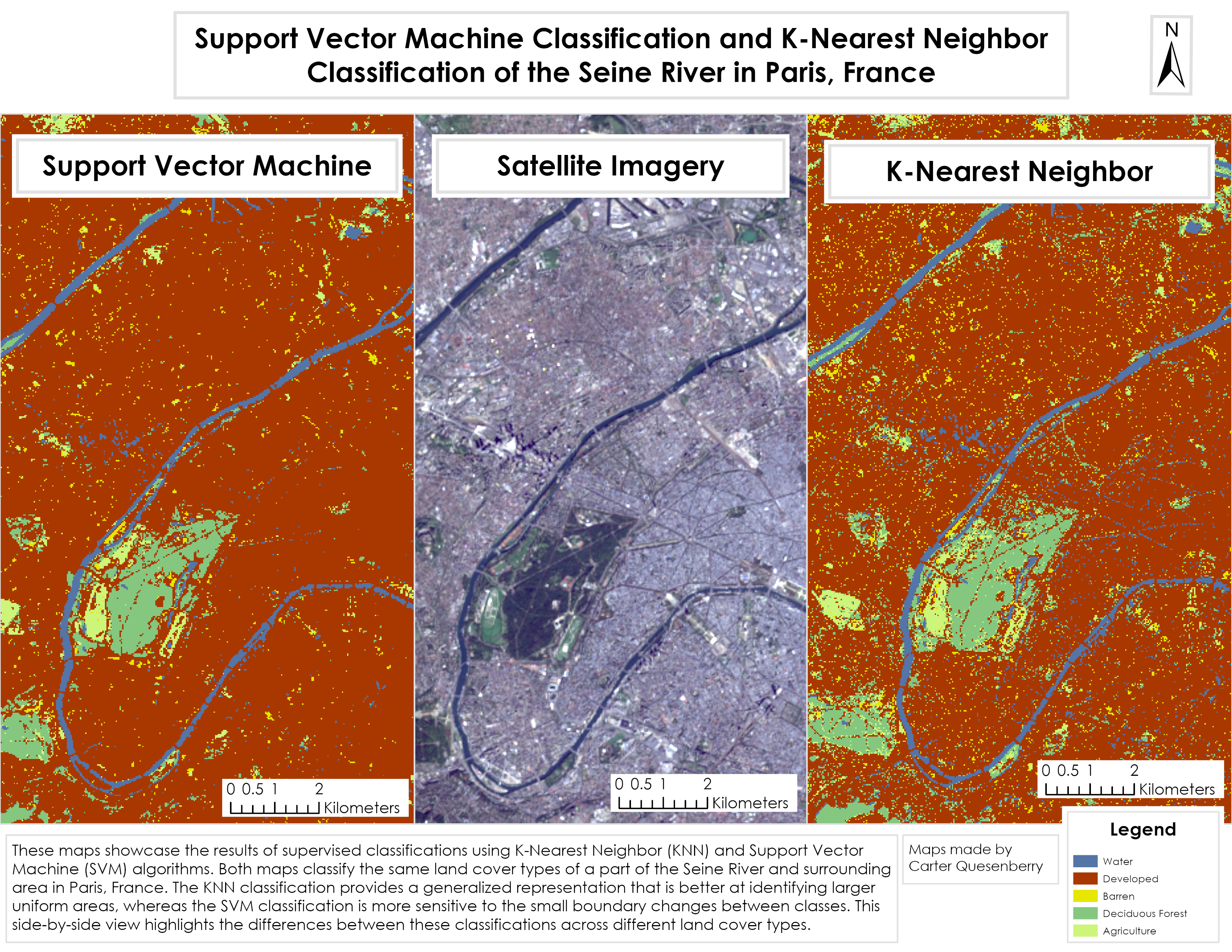
Supervised Classifications
Machine Learning
Comparative analysis of supervised classification algorithms including Maximum Likelihood, Support Vector Machine, and Random Forest for land cover mapping. This study evaluated accuracy and performance of different machine learning approaches.
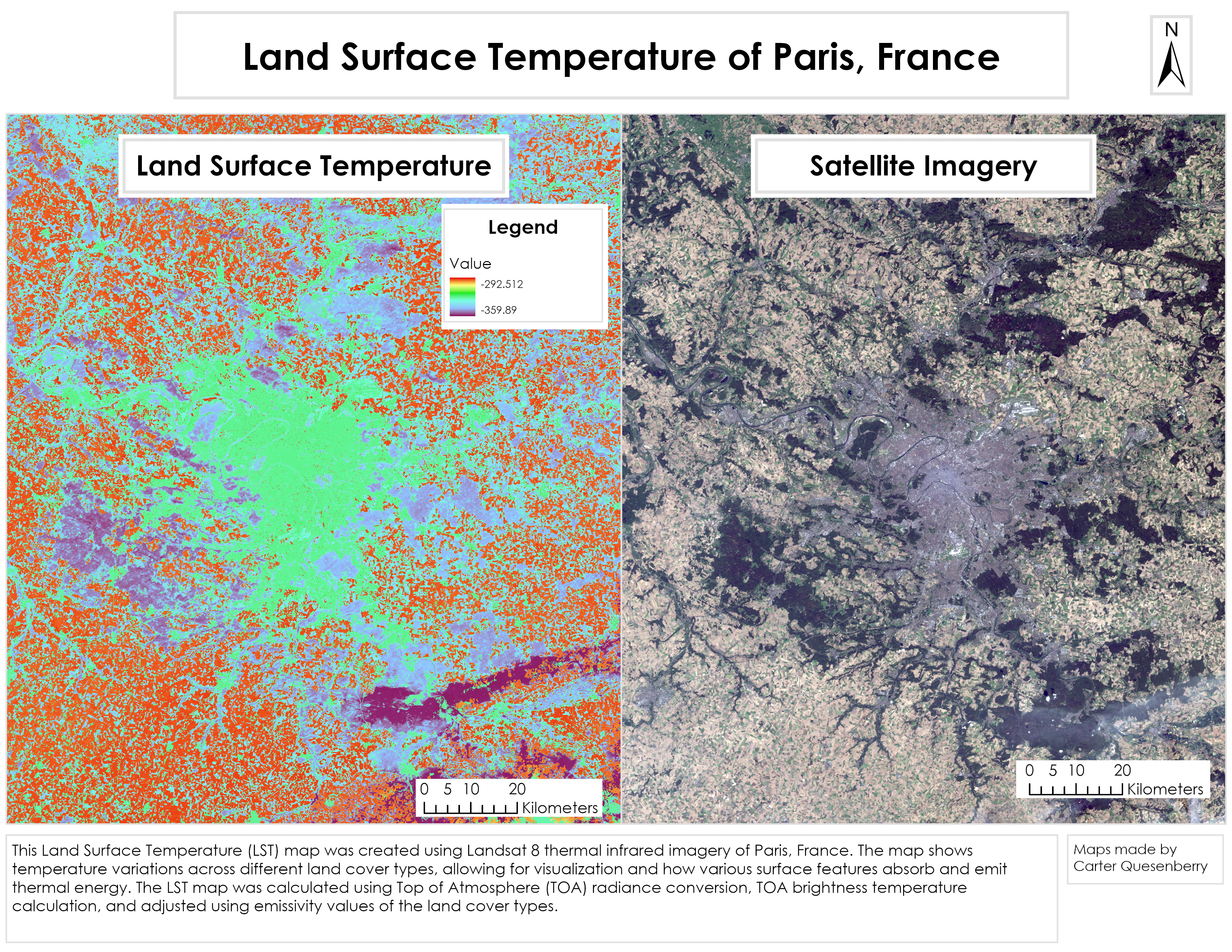
Land Surface Temperatures
Thermal Analysis
Land surface temperature analysis using thermal infrared satellite imagery to study urban heat island effects and temperature patterns. This project supports climate research and urban planning initiatives through thermal mapping.
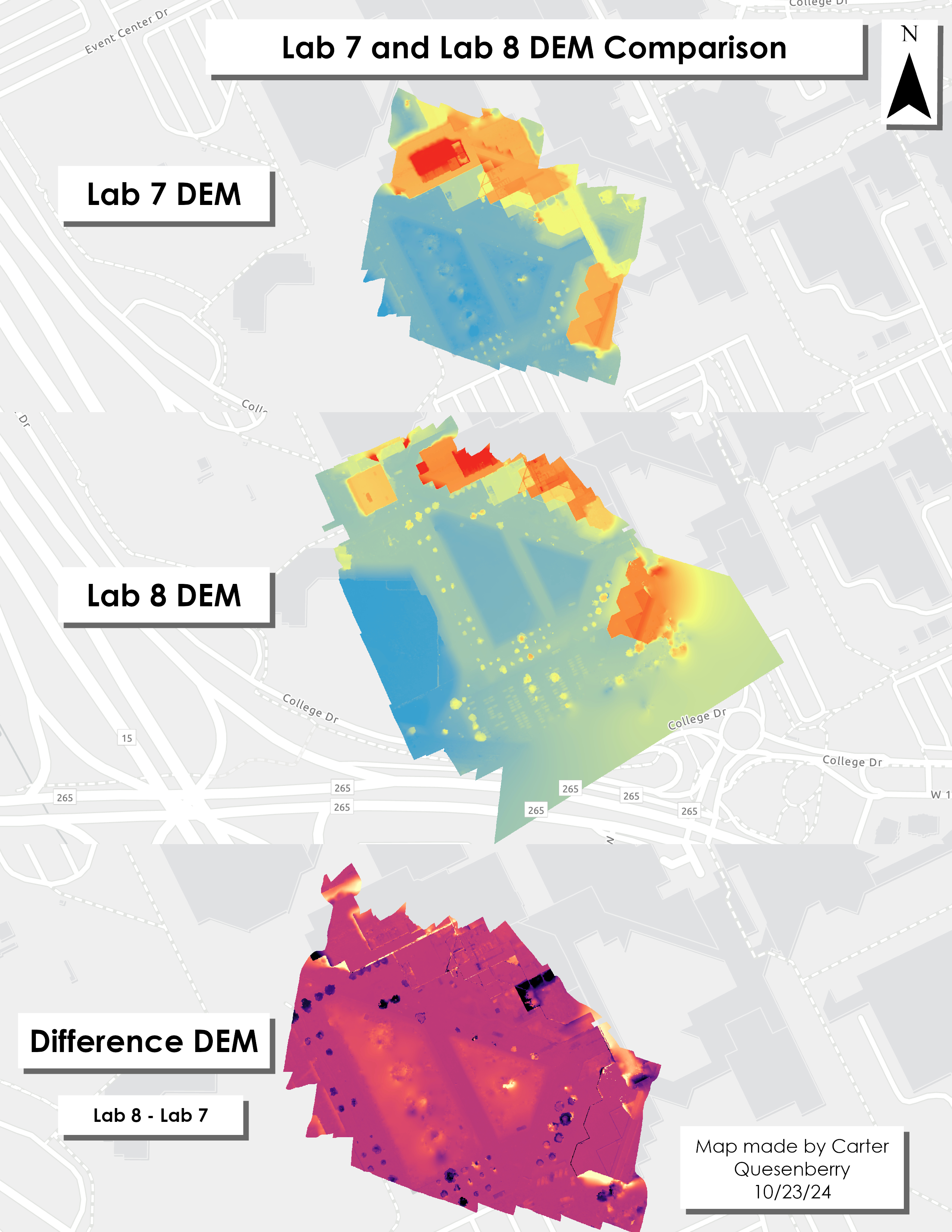
UVU DEM Comparison
Elevation Analysis
Multi-temporal Digital Elevation Model comparison of Utah Valley University campus showing elevation changes over time. This analysis identified areas of construction activity, erosion, and landscape modification using high-resolution elevation data.
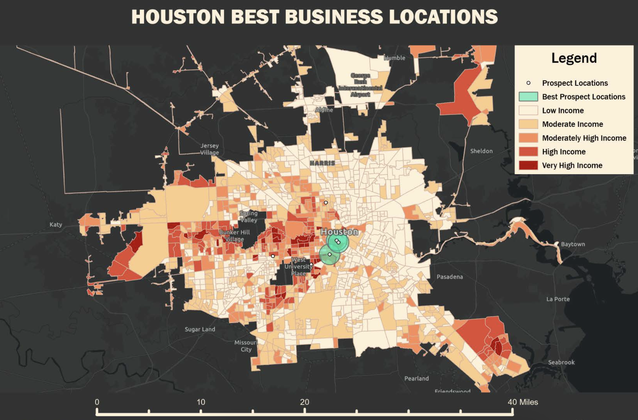
Best Prospect Business Locations in Houston, Texas
Business Intelligence
Comprehensive site suitability analysis for business development in Houston, Texas. This project integrated demographic data, transportation networks, zoning information, and economic indicators to identify optimal locations for commercial development.
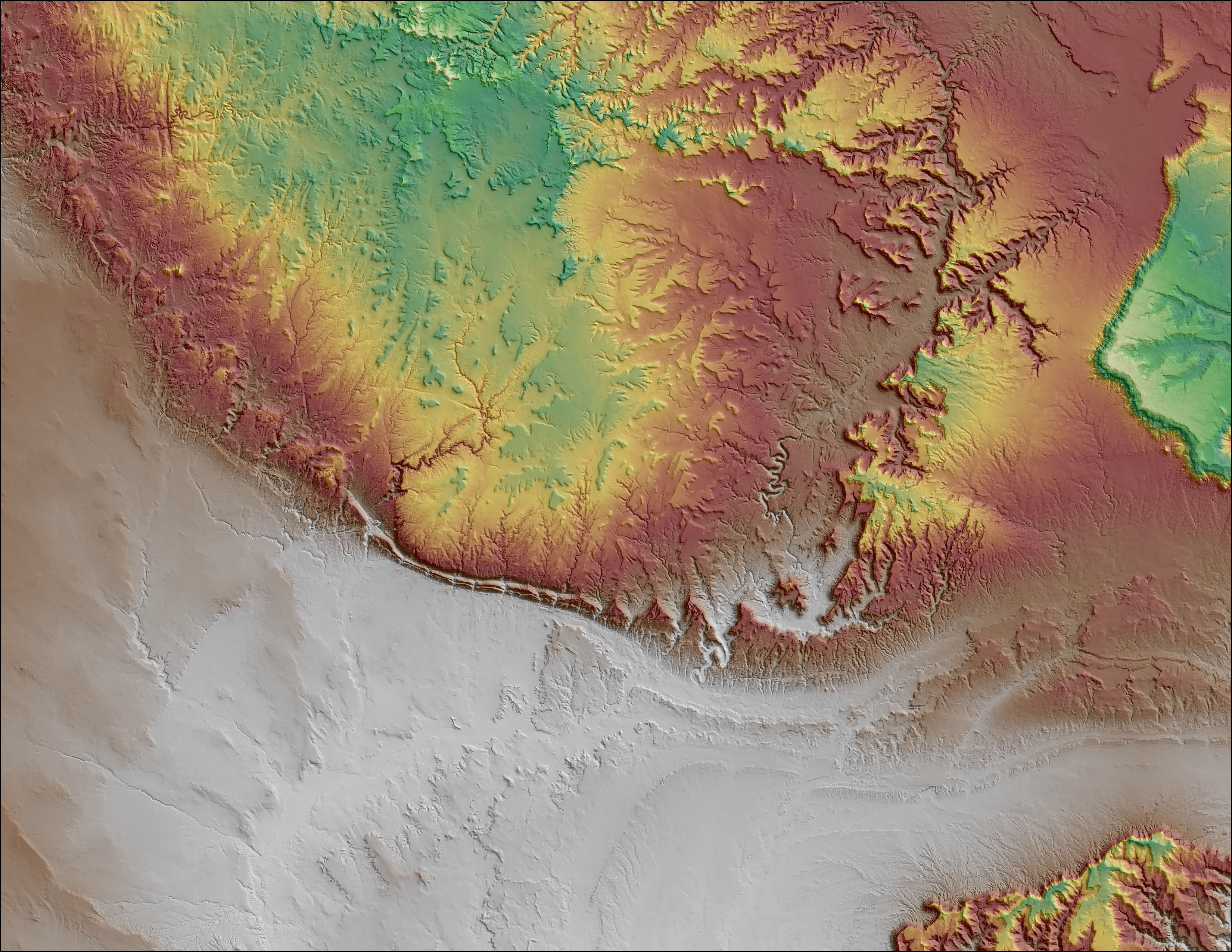
San Rafael Swell Shaded Relief
Cartographic Design
High-quality shaded relief map of the San Rafael Swell in Utah, showcasing advanced cartographic techniques and terrain visualization. This project emphasized the dramatic topography and geological features of this unique landscape.
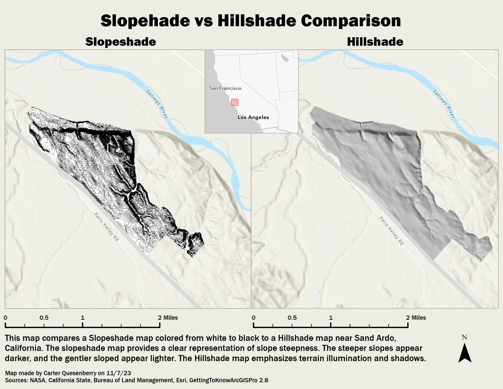
Slope and Hillshade Comparison
Terrain Analysis
Comparative terrain analysis showing slope calculations and hillshade visualizations from digital elevation models. This project demonstrates different techniques for terrain visualization and topographic analysis applications.
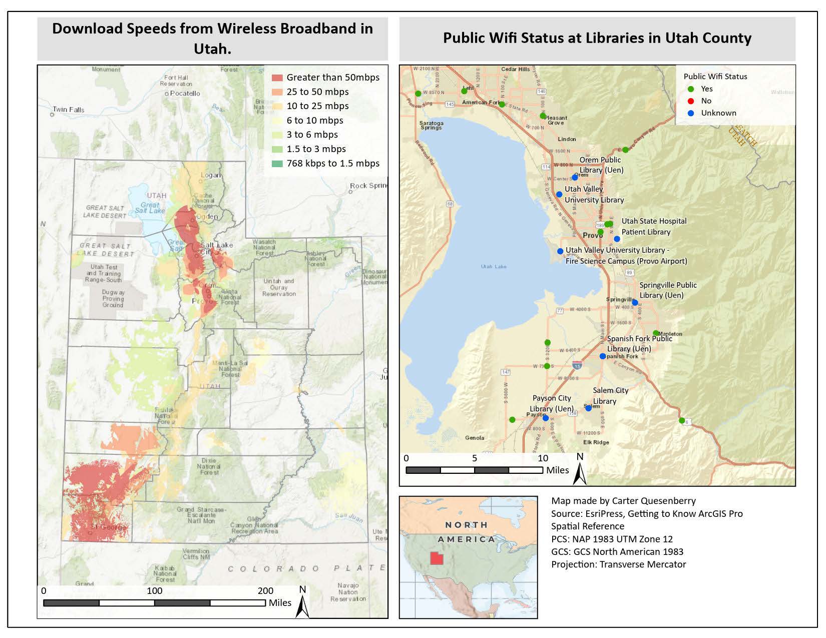
Download Speeds and Wifi Status in Utah
Connectivity Analysis
Comprehensive mapping of internet connectivity and download speeds across Utah communities. This analysis supports digital equity initiatives and infrastructure planning by identifying areas with limited broadband access.
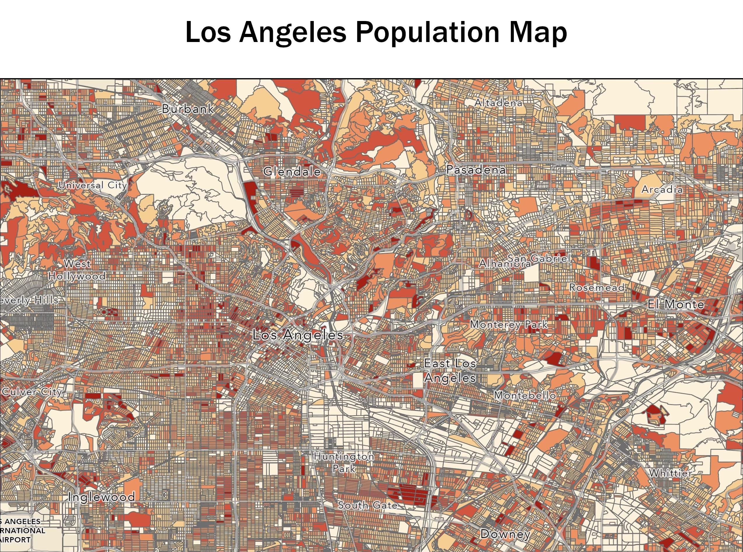
Los Angeles Population Map
Demographic Mapping
Detailed population density mapping of Los Angeles County using US Census data. This project utilized advanced symbology and statistical analysis to visualize population patterns, urban density, and demographic distributions across the metropolitan area.
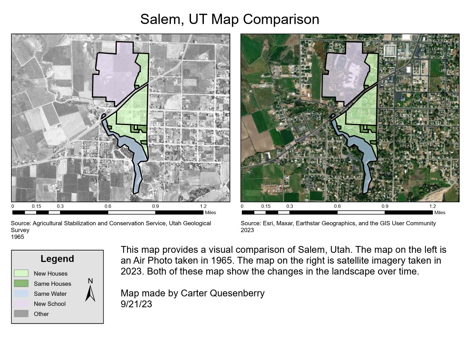
Changes in Salem, Utah
Urban Development
Multi-temporal analysis documenting urban development and land use changes in Salem, Utah over time. This project utilized historical imagery and current data to track growth patterns and development trends in this growing community.